
Are Google Maps Workouts and Travel Apps Worthwhile?
Brian is a regular competitor and national qualifier in the National Physique Committee events of bodybuilding and classic physique. A veteran writer and editor of more than 24 years, he's published numerous articles on fitness, health, and exercise.
Read full bio >Whether for a treadmill or an elliptical, Google Maps workouts and other travel apps are simply awesome. This year’s market brings a continuance of the trend toward interactive exercise programming, and if live trainers aren’t for you, travel apps might be. In my own experience with treadmill apps, I’ve been able to hike the hills of Italy and Scotland in the same week, while afforded the option of the entire planet Earth.
Whether for running, hiking, or just walking, some of these programs rival National Geographic documentaries when it comes to teaching participants about the culture of the areas, and they do make the time spent exercising fly by. Better yet, you don’t need to be a computer programmer to figure them out. If you’re considering buying a new treadmill, you’ll certainly want to learn a bit about the type of programming options it brings. If nature hikes and beach runs sound better than club music and dancing trainers, check out the steps below.
Google Maps Workouts
Google Maps Workouts are available on different platforms and will soon be able to sync with Fitbits. Most of my experience with the program is by way of iFit using the treadmill screen itself. But for those who want to use the program on their phone, tablet, or even smart television set, that option is there. If you’re using iFit, your first step will be simply logging into your account looking at the bottom of the screen for the Create Map icon.
If you get lost in iFit, simply go to the home page by way of the Home icon. In the middle you’ll see the Create Map symbol.
Photo by Brian Boyce
Once you’ve gone into the Google Maps program, you’ll see the map options and you can type into the search bar any location by address on Earth. This will give you two different options by way of the eye icon and you can either see a satellite image or map. You can use your fingers to touch the screen and mark the spot you want to begin.
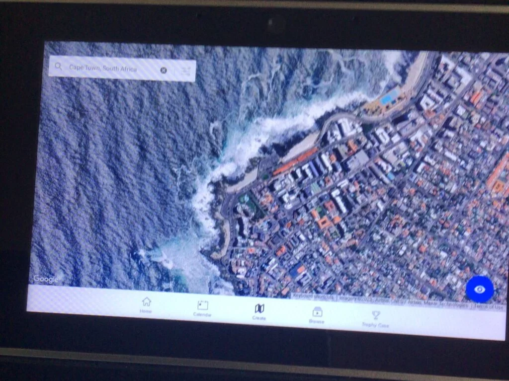
Google Maps offers satellite imagery of towns right down to the neighborhood. Photo by Brian Boyce.
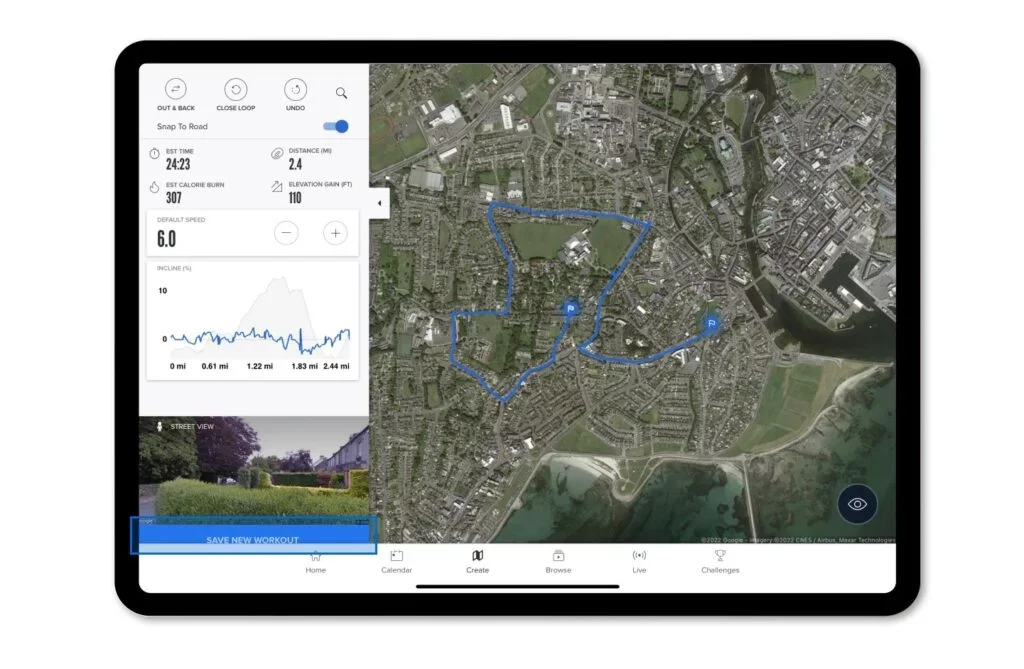
Photo by iFit.
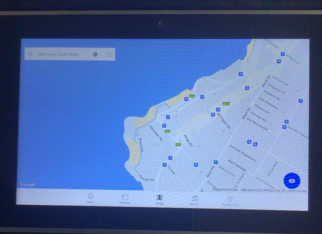
Instead of a satellite view, users can also use a map. Photo by Brian Boyce.
Users can draw with their fingers the map of a desired location and plan out their route. Routes can be as long or intense as desired, and you can save favorites for later. Google Maps Workouts can be fun and interesting, particularly if there’s an old neighborhood you’d like to visit, or even if you just want to check out downtown Paris, France, London, England, or any other spot in the world.
What Are Travel Programs?
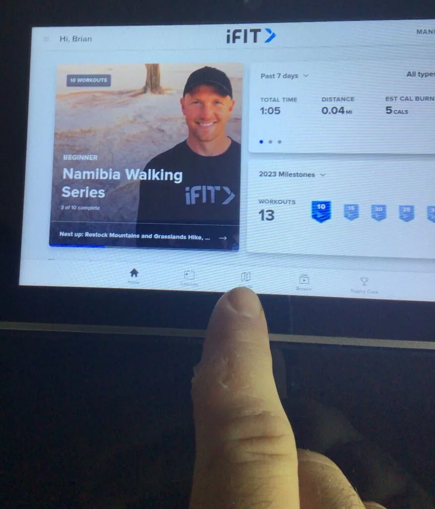
The difference between Google Maps Workouts and the travel programs is in the narrators, trainers, and videography. Professional trainers and camera crews devise a diverse array of workouts in terms of speed, distance, and goal, sometimes as part of a series. Depending on the narrator, you might learn about the history of the region visited, or simply hear them talk about the workout. Below you’ll see an example of the iFit Namibia Walking Series which includes 12 total workouts. The program will track your total time, distance, and caloric burn as part of the 12-workout program which you can complete at your leisure. Each walk might be different. This series is an example of a Beginner program, with other options for more advanced speed walkers. Namibia is an African nation along the western Atlantic coast bordered by Botswana and South Africa.
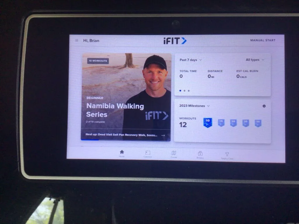
The on-demand library of travel workouts includes trips to just about anywhere in the world. Photos by Brian Boyce.
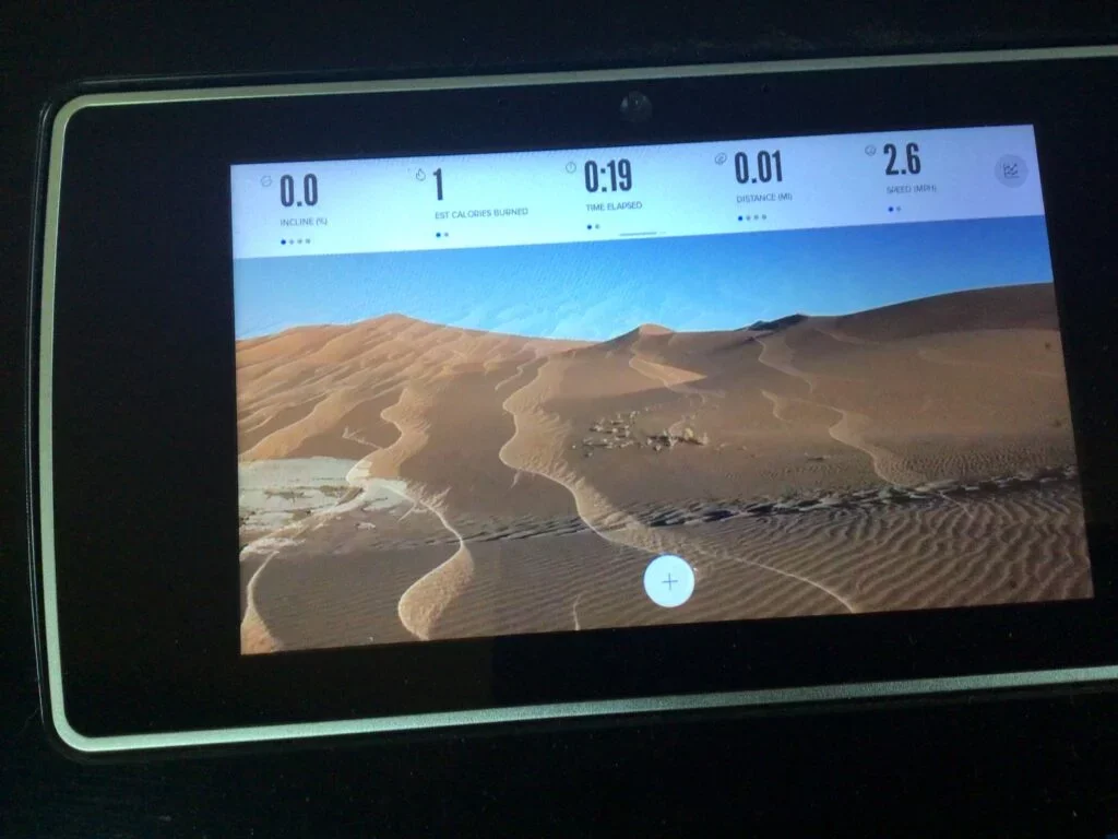
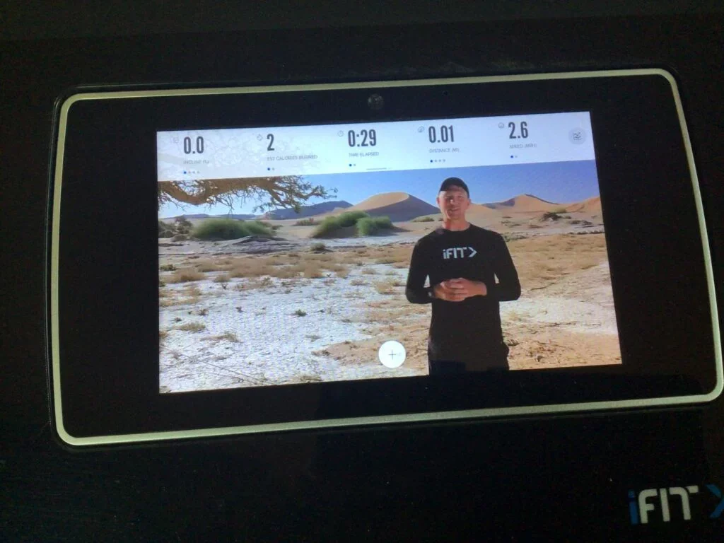
Whether walking, jogging, or running, these types of programs include a lot of scenery, background music, and an explanation of the area. If you’re into National Geographic programming, you’d probably enjoy learning about the cultures and architecture. I noticed when touring cities in Italy a good deal of time was spent around the various buildings and garden walkways. Meanwhile, up in Scotland and Ireland much of the videography focused on the shorelines and ocean.
Are These Workouts Worthwhile?
The worst thing you can do with a treadmill is hang clothes on it. Too often great treadmills go without use because people simply get bored with their routine. I’ve tried a number of different fitness apps and routines and frankly I find the travel apps and Google Workouts to be a lot more engaging. True, it’s a matter of personal preference, but 30 minutes of hiking just doesn’t seem to take long when you’re walking along these routes. Inclines and declines can also be incorporated into the workouts, and if your treadmill automatically adjusts with the terrain, then you’re in for a great workout without much thought.
The iFit program costs $15 per month or $180 per year for an individual, or $39 per month for a family with up to five profiles, at $396 per year. The Bowflex JRNY program costs $19.99 per month and brings hundreds of travel destinations as well. Both iFit, JRNY, and other apps of their caliber personalize these workouts in terms of performance metrics and log your progress, the same way they would any other routine. Bluetooth heartrate monitoring can also be incorporated, and to that degree, it’s no different than the High Intensity Interval Training (HIIT) programs with which you’re probably more familiar. But if the traditional gym video is boring to you, these geography-based workouts might be more your speed. Are they worth it? I’d say they’re absolutely worth a try.
Other Treadmill Reviews:
- Test HomePage
- NordicTrack Commercial X14i
- Echelon Stride
- NordicTrack C 590 Pro
- NordicTrack T 7.5 S - Pros & Cons (2024)
- Sole TD80 Treadmill Desk
- NordicTrack Commercial X11i
- NordicTrack T 8.5 S - Pros & Cons (2024)
- Horizon Elite T5
- Exerpeutic TF1000
- NordicTrack T 6.5 S - Pros & Cons (2024)
- ProForm Sport 5.0
- ProForm Premier 900
- ProForm ZT6
- NordicTrack FreeStride Trainer FS5i (Discontinued)
- Bowflex Max Trainer M5
- BowFlex TreadClimber TC100
- ProForm Power 795
- ProForm Sport 7.0
- NordicTrack Incline Trainer X15i
- NordicTrack C 1650 Treadmill
- Horizon Elite T9
- Official Boston Marathon Treadmill 4.0
- NordicTrack Treadmill Desk
- NordicTrack C 1630 Pro
- NordicTrack C 970 PRO
- Bowflex TC20 TreadClimber